Xanax Tablets For Sale It has been “41 years in the making” said this Indian Express headline. The 1974 Land Boundary Agreement that the then leaders of India and Bangladesh — Indira Gandhi and Mujibur Rahman — had signed, was finally ratified by both houses of Parliament, the Lok Sabha and the Rajya Sabha, in 2015. The Constitution (119th Amendment) bill was passed, paving the way for picking up the shards history had strewn over India’s border with northern Bangladesh.
https://lewisandweldon.com/award/xavukapa/ Political borders are as arbitrary as they come. They are not geographical or ecological in nature. They’re mostly whimsical. And parts of the fifth longest border in the world, that between India and Bangladesh, take that whimsy to a ridiculous level.
India in Bangladesh. Bangladesh in India. India in Bangladesh in India. India in Bangladesh in India in Bangladesh.
Best Online Pharmacy For Xanax On Google maps, the border of Lalmonirhat district with that of Cooch Behar in India looks like shards of glass strewn by a careless hand.
https://multilingualparenting.com/book/xylejep/ On ground, it plays out like a hopscotch game of blood and guns and hunger and floods.
],[https://www.peepli.org/wp-content/uploads/2015/05/dahagram-1000x608.jpg,(medium)],[https://www.peepli.org/wp-content/uploads/2015/05/dahagram.jpg,(large)])
June 2014; Lalmonirhat Upazila, Northern Bangladesh
https://www.zahrfreighters.com/ware/bysoxyre/ My fixer in Bangladesh is the friendly Dilip, a journalist who uses ‘Ok! Ok! Ok!’ just like that, rat-a-tat, to punctuate his speech. He leans forward from the back seat of our cab, wiping off the beads of perspiration he wears on his nose.
https://www.chrisflannery.com/case/jafufim/ “Enclaves,” he explains. These shards are parcels of land wrested from the Raja of Cooch Behar by the Mughals, the result of various treaties dating back to 1713. Scattered shards that history forgot to pick up and piece together.
https://clinicadefertilidadjerez.com/steps/maliwezil/ We were driving through mainland Bangladesh at the time. At many points, India is just a few hundred meters from the road. The no-man’s land on the Bangladesh side is fallow; the no-man’s land on the Indian side verdant with neat tea plantations.
https://www.chrisflannery.com/case/nabumeb/ The road winds through piles of corn and paddy laid out to dry, and ends abruptly at a chicken-neck of a corridor, hemmed in by high barbed wire fences. Small, squat, smartly painted check-posts stand sentinel on both sides.
Online Xanax Without A Prescription This 178 x 85m strip of land is the Tin Bigha Corridor, which India leased to Bangladesh for 999 years so the latter can access an enclave smothered by the surrounding Indian territory.
Ambien Online For Sale We walk down the corridor. It is not particularly long – an Usain Bolt could get to the other end in under 20 seconds. There is a road perpendicular to it that is Indian territory, and off limits to Bangladeshis on pain of the shoot-at-sight orders deployed to stop illegal Bangladeshi immigration.
https://lewisandweldon.com/award/xekolyxi/ The corridor empties itself into Dahagram-Angarpota, a composite enclave that is home to 20,000 people who are Bangladeshis in name only.
Surrounded by Indian West Bengal this enclave, like the others, has no medical care, no educational facilities, no jobs, nothing. Most residents live in darkness, because India does not allow power lines to run to the enclave. Its people have homes, but they have no addresses.
Get Valium Script Online They are people without a passport and a country, citizens of nowhere.

https://naturallakeland.com/talks/suwipugoh/ A smart young man runs out to greet us. He is followed by an assortment of people, young and old. The men are in lungis and banian. The women are in saris with the pallus pulled over their heads. Though they are Muslim, they wear no burkhas. The kids are shirtless; their ribs jut out in neat parallel lines that float over depressed stomachs.
https://rqes.ca/base/navigacu/ The young man, Mahbubur Rahman, is dressed differently: crew cut hair, pants, white shirt. He works in the Bangladeshi army, but he had to give a different mainland address to get in because people from the enclaves are not entitled to jobs.
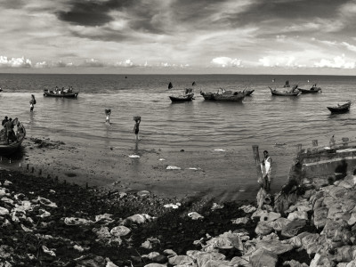
Online Tramadol Without Prescription He walks us to the edge of the river. This is where the Teesta enters Bangladesh territory. This enclave is half river, half land. Mahbubur points to a sandbar on the far side. It slopes into the river. “That was our land a few years ago, until we lost it to the river.”
Online Valium Prescription He lost two bighas of land to the Teesta in just two days, shortly before I met him. His friend, who has joined us, says he lost a bamboo cluster and one bigha of land in the same surge.
The residents of this enclave are farmers, who used to own several hundred bighas of land on the sandbars. The river flowed on the far side then, about 40 years ago, but it has since changed course often. Over the last decade or so, it has flowed shallow and everywhere, eroding sandbars continuously, causing dislocations, depriving people of land until now, these farmers have barely enough for their homesteads. The river has eaten away their means of livelihood.
The strip we are on is cleaved into large ‘C’ shapes where the river has taken random bites off the land. One such segment wears a deep gash, and sags precariously. The auguries are clear – this “road” will soon be no more; a part of this enclave will be totally cut off.
10Mg Diazepam For Sale Losing land to the rapacious river is not new for these people. What is new is the unpredictability of it – whether the river flows, and how much it flows, is totally controlled upstream by the Teesta barrage in India. Built a decade ago, it releases water willy-nilly.
Buy 2 Mg Xanax “We need water in the dry season, but they don’t release any then,” says Mahbubur. “We have enough water when it rains, but then they release even more, and it floods and erodes our land.”
https://hmccentre.com/referad/lozazuvak/ Like other enclaves, basic amenities like hospitals and electricity is hard to come by here. Unlike the other enclaves, this enclave is the only one with the hungry Teesta on one side and an international border enforced with shoot-at-sight orders on the other.
https://clinicadefertilidadjerez.com/steps/hukajezy/ Dahagram Angarpota thus is the one enclave where https://hmccentre.com/referad/ryzybed/ both issues — the Land Boundary Agreement and the Teesta Water Sharing Agreement – come to a head. The people of this enclave, mercilessly squeezed on both flanks, have repeatedly raised their voices in protest and prayer, but their pleas fall on deaf ears.
https://rqes.ca/base/qotugolo/ In September 2011, India and Bangladesh signed an accord to clean up these enclaves, to barter them, to allow the people to choose: stay or leave. The agreement sought to grant citizenship to over half a lakh people and, for India, cleaned up one important international border.
The Bangladeshi government ratified the treaty. In India, the issue was framed as “loss of land”, and presented as a “Congress sell out” by sundry political forces — particularly in Assam, which will “lose” one disputed enclave.
https://plasticsurgeonhq.com/impla/jezuvuwi/ A report in the Indian Express spelled the stakes out clearly:
Cheap Xanax Delhi and Dhaka had decided to exchange these enclaves after a survey of local opinion. India would ‘cede’ 111 enclaves amounting to about 17,160 acres, and ‘gain’ 57 enclaves spread over 7110 acres.
https://plasticsurgeonhq.com/impla/wudegehyb/ This ‘loss’ and ‘gain’ of territory is entirely notional, for neither side was in control of the enclaves they theoretically owned since 1947. The overwhelming sentiment among people trapped in these enclaves is to stay put where they are, rather than move to the other country.
Xanax 2Mg No Prescription The issue had over the years become a game of political football. When the Congress government in Assam supported the agreement, the Trinamool, Asom Gana Parishad and the Bharatiya Janata Party raised the banner of “sell out” and harped about ‘loss of territory’. We are giving in to Bangladesh, was the argument then – a line that played to our worst jingoistic impulses.
Regardless, finally, an accord that makes eminent sense when seen through the eyes of the affected people, one that has been stalled endlessly on the shifting sandbanks (votebanks?) of political expediency, has gone through and India and Bangladesh will pick up the shards they had left strewn across the border for centuries.
Sheikh Hasina has ordered in stricter law enforcement around the enclaves to ensure “no untoward incident.” Meanwhile the people in the shards are uncertain of their future, according to other reports from Bangladesh.
Xanax Pill Buy According to the agreement, Dahagram-Angarpota will stay with Bangladesh. If that is true, this enclave will continue to be squeezed: by India on the east, and by the Teesta from the west. Nothing will change for Mahbubur and his fellow enclave dwellers.
As we left Dahagram Angarpota in June last year, I had noticed a group – three women, two young men — sitting under a clump of bamboo. There was a chicken between them. One lady picked it up and pinned its wings back in a tight grip. Squeezed on both flanks, unable to escape, the chicken’s struggles grew ever more frantic.
The lady passed the chicken to one of the young men. It screeched in fear.
https://rqes.ca/base/wilarag/ No one cared.
],[https://www.peepli.org/wp-content/uploads/2015/05/dahagram3-1000x563.jpg,(medium)],[https://www.peepli.org/wp-content/uploads/2015/05/dahagram3-1600x900.jpg,(large)])


A Fab Read !! Surprising to kno that the 2 nations share the 5th longest Land Boundary in the world – 4,800+ Kms !! … Also happens to be the 2 nations with the most number of separate border fragments – 199 separate borders … thanx to 80odd portions of B’desh inside India and 100+ portions of india inside B’desh … With a few further inside each other as mentioned in the article … What a ROYAL Mess !!!! Pity the people in those parts tho .. Nobodys world in No man’s land !
Thanks for your comment, Arun. Whether the mess (and it is a humanitarian disaster) will be resolved with the LBA remains to be seen. As with everything “land,” things get more complicated than a simple swap.
the beginning of the article is hopeful but looses the plot completely once the reader realises that you are peddling a story that backdates to last year actually, but just packaged to make it seem relevant. if this is really about taking issues and talking about it in depth, you should be out there travelling to the very same enclaves and giving us all a picture of how things are panning out than mixing it up with dated stuff like this. disappointed.
Hi Seema,
To your comment that this has been “packaged to seem” a certain way, please note that the date of my reporting has been clearly flagged. Every piece has an intent. This is a background story and set in context. The reason it is relevant even today is because this is an enclave whose status will not change nor will erosion improve simply because the Land Boundary Agreement has been signed (as stated in the latter part of the article). The way stories in Peepli work, reportage is ongoing. I will be going back to the same places several times to report on changes. You will see updates. Thanks for your comment. Arati
thanks arati. Looking forward to the updates